
Hiking guide
Kenya's best hikes: from Kilimambogo to Mt Elgon
Kenya has hikes for every level, from a shaded forest walk inside Nairobi to multi-day climbs on the country's three highest mountains. Here are the ones we map, grouped by area, with the distance on our map and a short note on what each is like. Each has its own guide with the route, seasons and fees.

Near Nairobi
Karura Forest: a large forest on the northern edge of the city, with wide, mostly flat paths, streams, a waterfall and caves. Our Gate A to Gate F route is about 5.8 km. The easiest hike here, and good for families and runners.
Ngong Hills: a ridge of rounded peaks just south-west of Nairobi in Kajiado County, with the Rift Valley on one side and the city on the other. The traverse is about 8.7 km one way on our map. Moderate, exposed and windy, and one way, so plan transport for the end.
Ol Donyo Sabuk (Kilimambogo): a lone forested mountain about 25 km east of Thika, rising to 2,145 m. The route follows the rough park road from the KWS gate to the summit, past McMillan's grave, with a KWS ranger. About 9 km one way on our map, and about five hours there and back.
Rift Valley
Mt Longonot: a dormant volcano near Lake Naivasha, about two hours from Nairobi. The climb to the rim is steep and dusty, and the loop round the crater adds sharp ups and downs. The full loop is about 10.5 km on our map. Hard, with little shade.
Hell's Gate gorge: a walk down into Ol Njorowa Gorge in Hell's Gate National Park, past hot springs and steam vents between red cliffs. About 2.6 km one way on our map. Short, with some scrambling; a guide is compulsory, and flash floods are a risk in the rains.
Mt Suswa: a double-crater volcano between Narok and Nairobi, with a forested trench round a block of rock in the middle. The rim path from the crater campsite to the 2,356 m summit is about 5.3 km one way on our map, and about four hours there and back. Easy to moderate, but the drive in needs a 4WD.
Aberdares
Elephant Hill: the long ridge at the southern end of the Aberdares, climbed from Njabini Forest Station through farmland, muddy bamboo and moorland to summits above 3,600 m. About 9.1 km one way on our map, and seven hours or more. Moderate to hard.
Kinangop via Elephant Hill: a two-day trek that carries on from Elephant Hill across the moorland on buffalo trails to Kinangop, the range's second-highest peak at 3,906 m, finishing with a short rock scramble. About 14.1 km one way on our map. Hard, with camping and navigation.
Ol Donyo Lesatima: the highest peak in the Aberdares at 4,001 m, and the third-highest in Kenya. It starts on the moorland at about 3,600 m, so the walk is short: about 6.4 km one way on our map and about four hours there and back. All Aberdares hikes need an armed KWS escort.
Mt Kenya
Three main routes lead to Point Lenana, the 4,985 m summit of Mt Kenya that hikers can reach without technical climbing. All are multi-day climbs in Mt Kenya National Park.
Sirimon: from the north-west, on the Nanyuki side. The gentlest gradient and the best for getting used to the altitude, usually over four or five days. About 24.2 km to Point Lenana on our map.
Naro Moru: from the west, and the most direct way to the top, with bunkhouses at each camp. It can be done in three days but is the steepest, with the wet Vertical Bog on the way. About 22.7 km on our map.
Chogoria: from the east, past deep gorges and mountain lakes, and often used for the descent after going up Sirimon. About 19 km on our map.
Mt Elgon
Koitobos Peak: the highest point of Mt Elgon in Kenya, at 4,222 m, on the rim of one of Africa's largest calderas. In dry weather a 4x4 can drive from Chorlim Gate to the road end above 3,500 m, and the summit is about two hours' walk from there. About 5.8 km one way on our map.
Keep the hike
Every hike here is available as a framed 3D map: the real terrain printed in relief, your route raised in colour, and your names and date on the card under the glass. If you took a different line, upload your GPX and we print your exact route.
Common questions
What is the easiest hike near Nairobi?
Karura Forest. Our Gate A to Gate F route is about 5.8 km on wide, shaded, mostly flat paths inside the city.
What is the toughest day hike near Nairobi?
Elephant Hill in the Aberdares is a long, tough day: about 9.1 km one way on our map, through deep bamboo mud to summits above 3,600 m, and seven hours or more on foot. Mt Longonot is the hardest of the Rift Valley day hikes.
What are the highest mountains you can hike in Kenya?
Point Lenana on Mt Kenya at 4,985 m, Koitobos Peak on Mt Elgon at 4,222 m, and Ol Donyo Lesatima in the Aberdares at 4,001 m.
Do you need a guide or ranger to hike in Kenya?
It depends on the hike. Ol Donyo Sabuk needs a KWS ranger, the Aberdares need an armed KWS escort, and Hell's Gate gorge needs a guide. On Mt Suswa the conservancy collects fees and can arrange a guide. Each guide sets out the current rules and fees.
The maps in this guide
-
 Mt Longonot crater rim Framed 3D map · from KES 4,000
-
 Mt Kenya Sirimon route to Point Lenana Framed 3D map · from KES 4,000
-
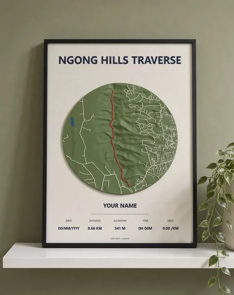 Ngong Hills traverse Framed 3D map · from KES 4,000
-
 Karura Forest, Gate A to Gate F Framed 3D map · from KES 4,000
-
 Hell's Gate gorge walk Framed 3D map · from KES 4,000
-
 Elephant Hill, Aberdares Framed 3D map · from KES 4,000
-
 Ol Donyo Sabuk (Kilimambogo) summit Framed 3D map · from KES 4,000
-
 Mt Kenya Naro Moru route to Point Lenana Framed 3D map · from KES 4,000
More guides
- Mt Kenya routes compared: Sirimon, Naro Moru and Chogoria
- Ngong Hills hike: distance, climbing and what to expect
- Gift ideas for runners in Kenya
- Mt Longonot hike: the crater rim loop explained
- Karura Forest walk: Gate A to Gate F
- Nairobi marathons: the StanChart and Nairobi City Marathon courses
- How to download a GPX file from Strava, Garmin and other watches
- Day hikes near Nairobi: Ngong Hills, Longonot and Karura
- The World Marathon Majors explained
- How to display your marathon medal and race bib
- Kilimanjaro routes compared: Marangu or Machame
- Three classic South Africa hikes: Table Mountain, Lion's Head and the Amphitheatre
- African marathons worth running: from Kilimanjaro to Comrades
- Berlin Marathon course guide: route, landmarks and 2027 entry
- Boston Marathon course guide: Hopkinton to Boylston Street
- Chicago Marathon course guide: the Grant Park loop and 2027 entry
- London Marathon course guide: Greenwich to The Mall
- New York City Marathon course guide: five boroughs and five bridges
- Sydney Marathon course guide: Harbour Bridge to the Opera House
- Tokyo Marathon course guide: Shinjuku to Tokyo Station
- Paris Marathon guide: the course, landmarks and the 2027 race
- Rotterdam Marathon course guide: Erasmus Bridge to the Coolsingel
- Valencia Marathon course guide: a flat, fast race in December
- Nairobi City Marathon: course, Expressway route and 2027 date
- Lagos City Marathon: the coastal road course and 2027 date
- Cape Town Marathon: course, Majors status and 2027 date
- Kilimanjaro Marathon: Moshi course, hills and 2027 date
- Two Oceans Ultra Marathon: the 56 km course and 2027 date
- Comrades Marathon: the down run course, hills and 2027 date
- Hell's Gate gravel ride: LOOP Safari Gravel route in Naivasha
- Limuru gravel ride: the LOOP Safari Gravel route through tea country
- Machakos gravel ride: the Safari Gravel Series route
- Sirimon route, Mt Kenya: day by day to Point Lenana
- Naro Moru route, Mt Kenya: the direct way to Point Lenana
- Chogoria route, Mt Kenya: lakes, gorges and Point Lenana
- Marangu route, Kilimanjaro: hut by hut to Uhuru Peak
- Machame route, Kilimanjaro: day by day to Uhuru Peak
- Mount Meru climb: the Momella route to Socialist Peak
- Platteklip Gorge hike: the direct way up Table Mountain
- Lion's Head hike, Cape Town: the spiral path to the top
- Drakensberg Amphitheatre hike: Chain Ladders to Tugela Falls
- Standard Chartered Nairobi Marathon 2027: course, date and entry
- Ol Donyo Sabuk hike: climbing Kilimambogo from the KWS gate
- Mt Suswa hike: the inner crater rim to the summit
- Ol Donyo Lesatima hike: the Aberdares' highest peak
- Elephant Hill hike, Aberdares: Njabini to the summit
- Kinangop via Elephant Hill: a two-day Aberdares trek
- Koitobos Peak hike: Mt Elgon's highest point in Kenya
- Hell's Gate gorge walk: into Ol Njorowa Gorge, Naivasha